Middle World in the Early Bronze Age.

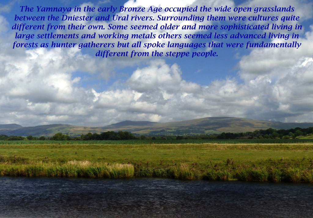
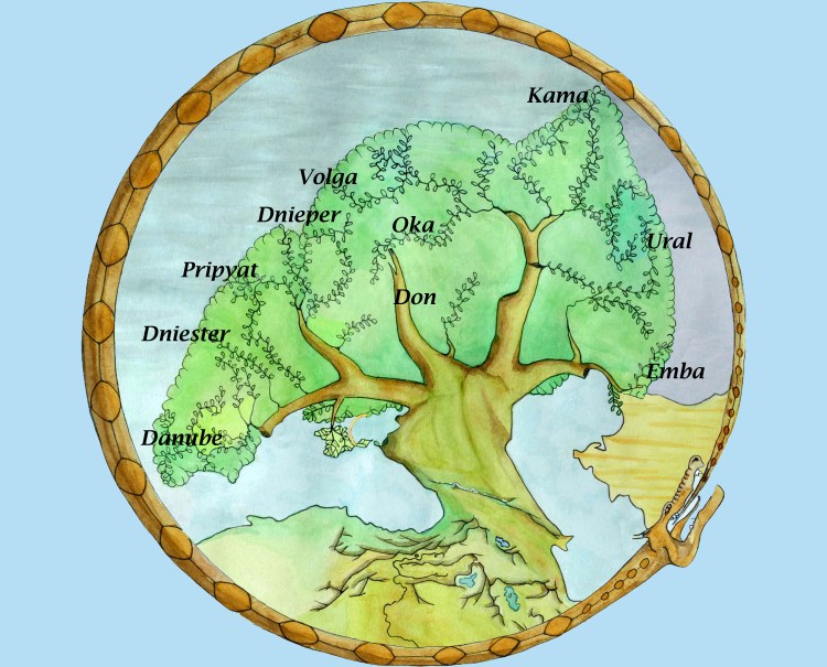
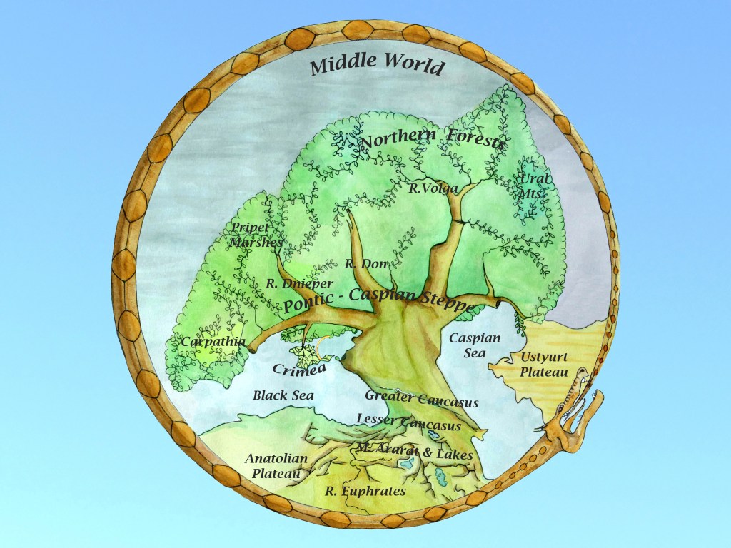
By the early Bronze Age the lakes and forests of the north continued to be the home to hunter-gatherers, the surrounding mountains were exploited for metals and fertile regions along rivers had long been farmed with large settlements established over time in some places. 

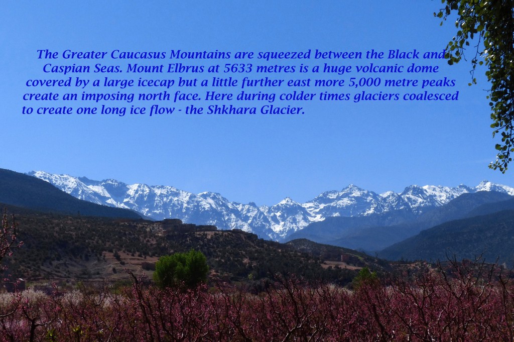
Sophisticated agriculture such as terracing and wine production were to be found on the flanks of the Caucasus, where advances in metallurgy were also taking place. Further south along the Euphrates River were emerging large urban centres while to the north on the wide grasslands a mobile steppe culture had developed around the invention of the wheel and the domestication of the horse. 

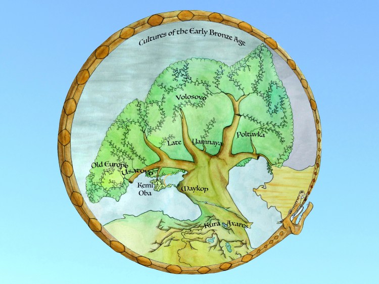
Of these last people only their burial sites or kurgans have left any impression on the landscape or in the archaeological record but their impact on surrounding cultures stretching far beyond their homeland would be immense over subsequent centuries and even millennia spreading language and ideas across the whole world.

This culture, we refer to as the Yamnaya, then established itself around the shores of the Baltic during the Bronze Age and is sometimes referred to as the Battle Axe culture for these weapons were found in grave sites and judging from further archaeological evidence it was a weapon they were not afraid to use. This suggests that the take over by axe wielding, horse riding warriors of this and other areas was not done peacefully.  

These sharp bronze axes had uses beyond weapons. They acted as an early form of currency and were adapted for cutting down trees. They also enabled the shaping of wood to be done more accurately and led to rapid improvements in boats and wheeled vehicles like carts and chariots. This in turn made societies more mobile and led to many more trees being felled for building but mainly to produce bronze needed in both smelting and mining of the ores. This caused an economic stimulus across the Old World and allowed the population to rise and more land given over to farming, which also benefited from bronze edged ploughs.  

The Old World

By the old world I am referring to the famous Ptolemy map which depicts the world stretching from the British Isles across to Sri Lanka. This was the world of the Iron Age and by the height of the Roman Empire was an integrated economic entity. During the Bronze Age though it was the area that Indo-Europeans spread across starting from their heartland on the Pontic Steppes, which was close to the middle of the known world until the Medieval period. 

The depiction of my World Tree corresponds with the extent of the Black-Caspian Seas drainage basin. The branches with leaves mark the courses of major rivers. The black and brown markings at the base of the tree show the trend of the main mountain ranges from the Caucasus south  into Anatolia giving the appearance of a tangle of roots. The coastlines of the Sea of Azov and the Caspian Sea are depicted as they might have been in the early Bronze Age 5,000 years ago.  With the exception of the Caspian Sea it is fairly accurately depicted on the Ptolemy map including the major rivers including the Volga suggesting it was well integrated into the economy of the old world and close to its centre.

An introduction to Middle World

Scandinavia in prehistory was mostly a carpet of northern forest interspersed by sheets of water with a climate of long winters and short summers. This landscape and climate continues across the eastern extension of the North European Plain and it is necessary to travel far to the south to discover a break in this uniformity. The nine worlds of Norse mythology however are widely diverse with lands that are hugely contrasting yet can be close to one another. This would suggest the neck of land between the Black and Caspian Seas with which their distant ancestors were familiar in the early Bronze Age before they began to spread out across much of the old world.

The Greater Caucasus forms a barrier which traverses this neck of land and affects the weather and climate of the whole region. The north side of the range is exposed to icy winds from the northeast while to the south the mountains offer some protection from this chilling cold. The Lesser Caucasus meanwhile create an east west barrier to moisture coming in from the west over the Black Sea. This barrier extends north to include the highest mountains of not just the Greater Caucasus but the whole of Europe. Together these two ranges of mountains create a rain shadow to the east along the Caspian Sea coast of Azerbaijan and extending north.

This makes the Islamic republic quite different in appearance from its Christian neighbour of Georgia to the west facing the Black Sea. The Caspian coast of Azerbaijan gets only a third of the rain of Georgia’s Black Sea coast, while the crucial winter rains in the east only amount to a quarter of those west of the Lesser Caucasus. This is mitigated however by the drainage of water from west to east, along the Kura and Aras rivers (1,500 and 1,000 kilometres long respectively), which meet on the parched plains of Azerbaijan so that precipitation from both the Greater and Lesser Caucasus helps irrigate this otherwise rain starved area. The headwaters of the Euphrates (Firat and Murat rivers) in the nearby mountains of eastern Anatolia are equally crucial in irrigating the hot arid plains of Iraq far to the south.

The Geography of Eastern Europe.

Scandinavia in prehistory was mostly a carpet of northern forest interspersed by sheets of water with a climate of long winters and short summers. The nine worlds of Norse mythology however are widely diverse with lands that are hugely contrasting yet can be close to one another. This would suggest that this world was inspired by far off lands with which their distant ancestors were familiar in a place that was geographically close to the centre of the old world.

From the map above of annual rainfall averages across Europe it is noticeable that the line of Longitude 20 degrees east marks a dividing line between the wetter west and drier east of the continent.  The west has a more maritime climate while the east has a more continental one with cold dry winters and summer rainfall. To the west the only exception is southern Spain which is dry but to the east the inland seas of the Baltic and Black Sea allow more precipitation to penetrate deeper into the continent. In the case of the Black Sea this is magnified by the mountains, which surround its eastern shores especially the Caucasus, Europe’s highest range.

This geography creates a greater mix of habitats especially in the southeast of the continent where there are a series of alternating zones ranging from forest to desert.  Over the last eight thousand years the climate has been remarkably stable (Compared with a similar period preceding it.) allowing civilisation to progress to its present level. There have been regular fluctuations in the jet stream however, which have had an impact on regional climates. This would have had a greater impact further east if rain bearing westerlies failed to penetrate at times into lands which were already marginal, especially for farming. In the north this would have produced colder winters and in the south more desert.  This variation in climate and habitats would have been critical to early farmers who would have had to adapt to changing conditions so ultimately the more adaptable and mobile would be the most successful.

See the Mountain Ranges of Middle World Blog.