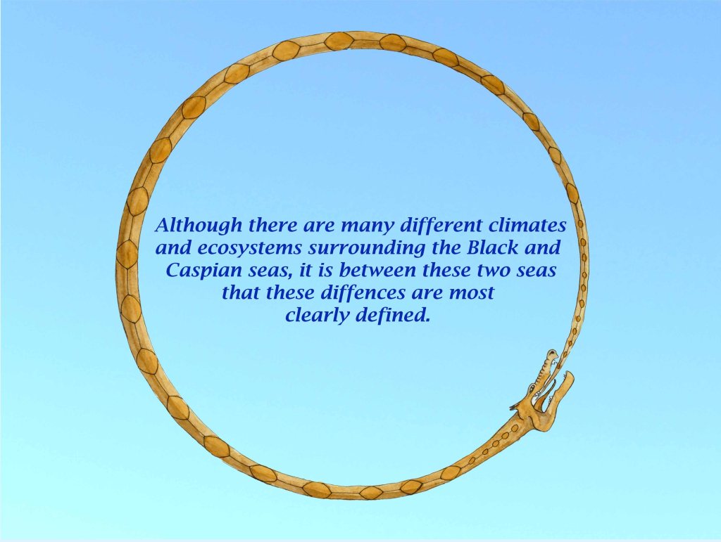
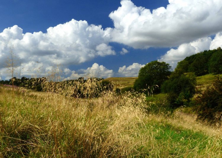
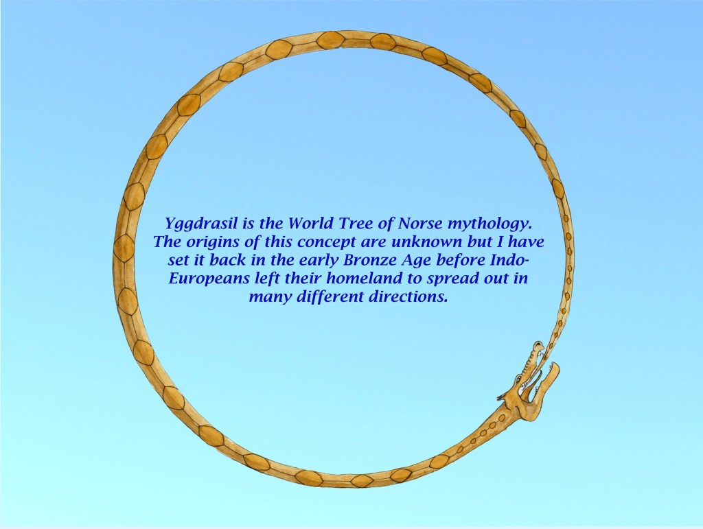
Scandinavia in prehistory was mostly a carpet of northern forest interspersed by sheets of water with a climate of long winters and short summers. This landscape and climate continues across the eastern extension of the North European Plain and it is necessary to travel far to the south to discover a break in this uniformity. The nine worlds of Norse mythology however are widely diverse with lands that are hugely contrasting yet can be close to one another. This would suggest the neck of land between the Black and Caspian Seas with which their distant ancestors were familiar in the early Bronze Age before they began to spread out across much of the old world.
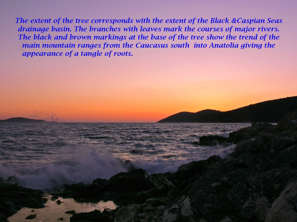
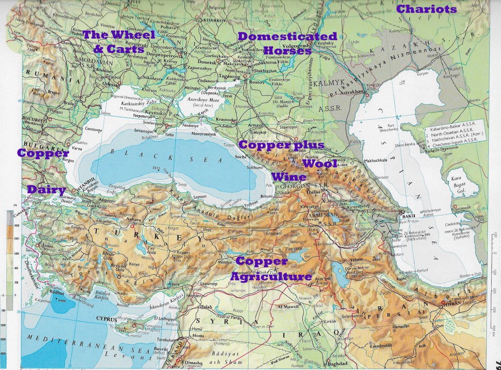
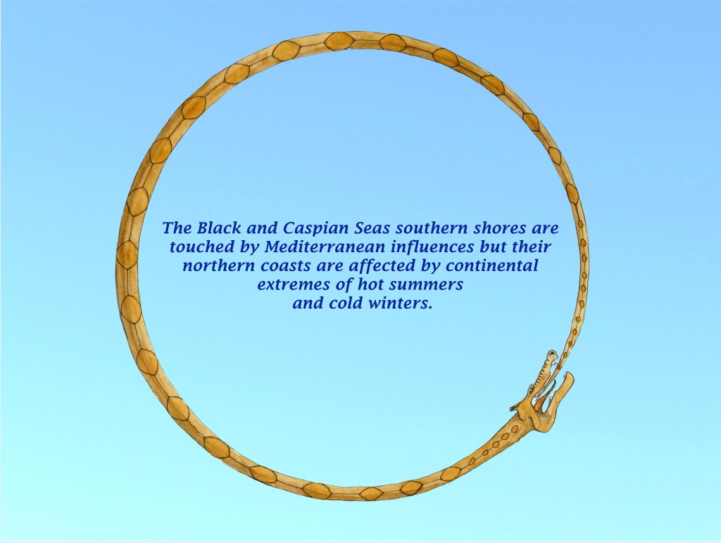
The Greater Caucasus forms a barrier which traverses this neck of land and affects the weather and climate of the whole region. The north side of the range is exposed to icy winds from the northeast while to the south the mountains offer some protection from this chilling cold. The Lesser Caucasus meanwhile create an east west barrier to moisture coming in from the west over the Black Sea. This barrier extends north to include the highest mountains of not just the Greater Caucasus but the whole of Europe. Together these two ranges of mountains create a rain shadow to the east along the Caspian Sea coast of Azerbaijan and extending north.
This makes the Islamic republic quite different in appearance from its Christian neighbour of Georgia to the west facing the Black Sea. The Caspian coast of Azerbaijan gets only a third of the rain of Georgia’s Black Sea coast, while the crucial winter rains in the east only amount to a quarter of those west of the Lesser Caucasus. This is mitigated however by the drainage of water from west to east, along the Kura and Aras rivers (1,500 and 1,000 kilometres long respectively), which meet on the parched plains of Azerbaijan so that precipitation from both the Greater and Lesser Caucasus helps irrigate this otherwise rain starved area. The headwaters of the Euphrates (Firat and Murat rivers) in the nearby mountains of eastern Anatolia are equally crucial in irrigating the hot arid plains of Iraq far to the south.
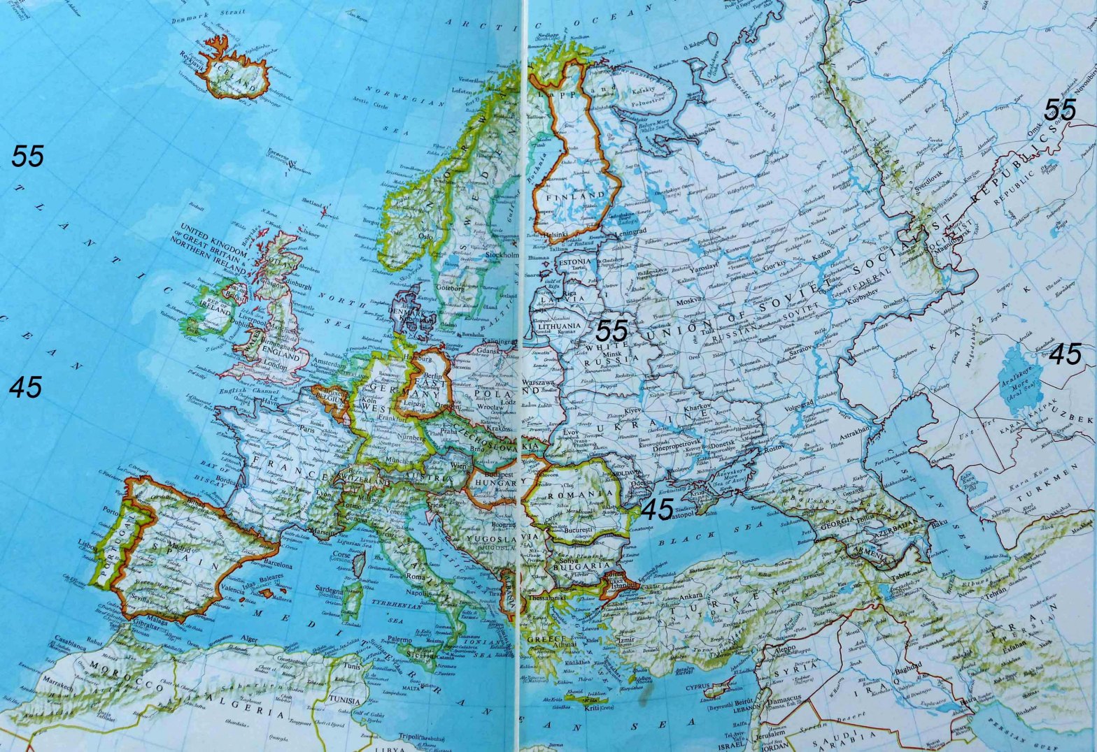
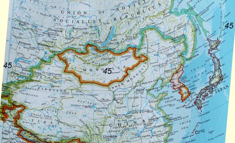
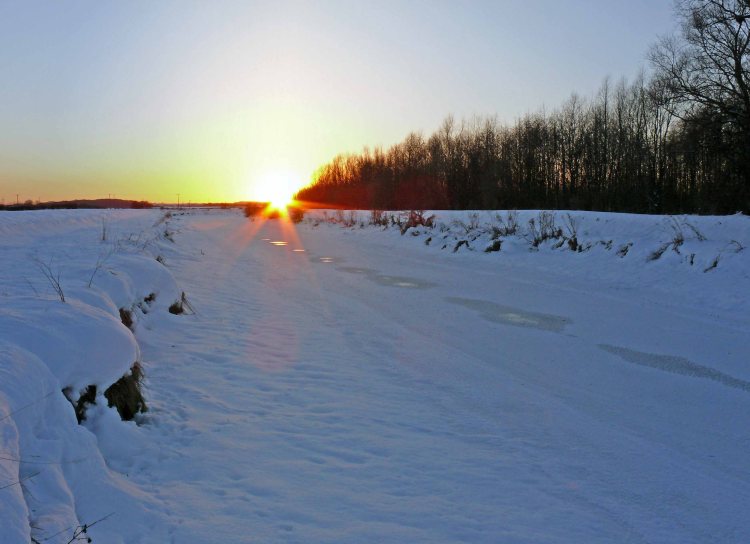
The 45th Parallel is a line equidistant between the equator and the pole that circles the world. In the southern hemisphere this crosses mostly ocean only passing over sparsely populated Patagonia and the southern tip of New Zealand known as Fjordland. The northern 45th parallel however crosses the widest part of both the Eurasian continent and the United States. It could be said to separate the cold north from the warm south, although because it crosses large areas of high ground this is not always the case.
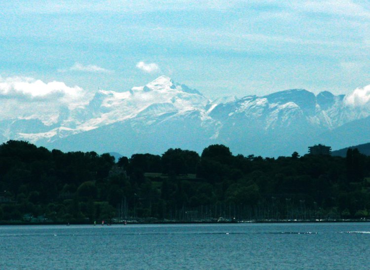
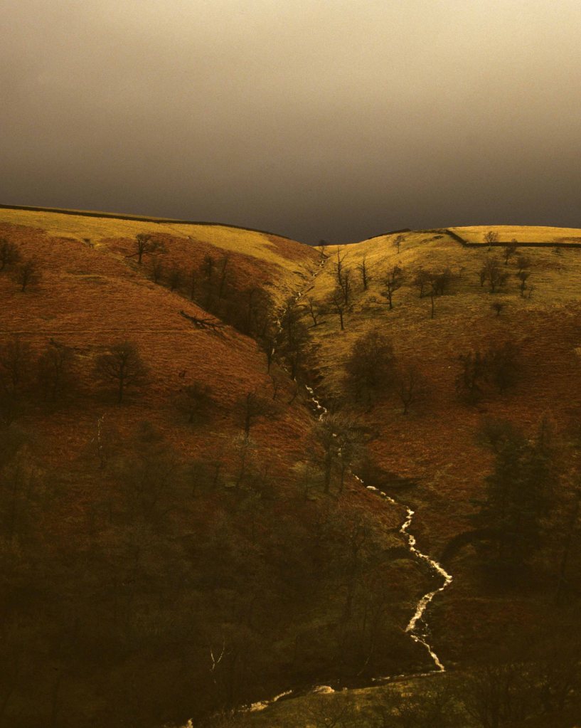
Western Europe illustrates this quite neatly. The 45th parallel comes ashore in the famous wine region of the Medoc near the city of Bordeaux. The benign effect of the Gulf Stream just off shore gives this region an enviable climate of warm summers and mild winters. Yet just inland is the Massif Central where the climate average is closer to that of northern England. This difference is due to much of the region being over 1,000 metres. It has brief warm summers and cold snowy winters which is more typical for the latitude. A little further east on the French Italian border the line crosses the Alps. Just to the north of it is Mont Blanc at 4,810 metres with much of the top half of the mountain permanently covered in snow or glaciers. Receding slowly today just two hundred years ago glaciers threatened to destroy the now famous ski resort of Chamonix. Yet not far to the south is the sunny Cote D’Azur overlooking a balmy Mediterranean.
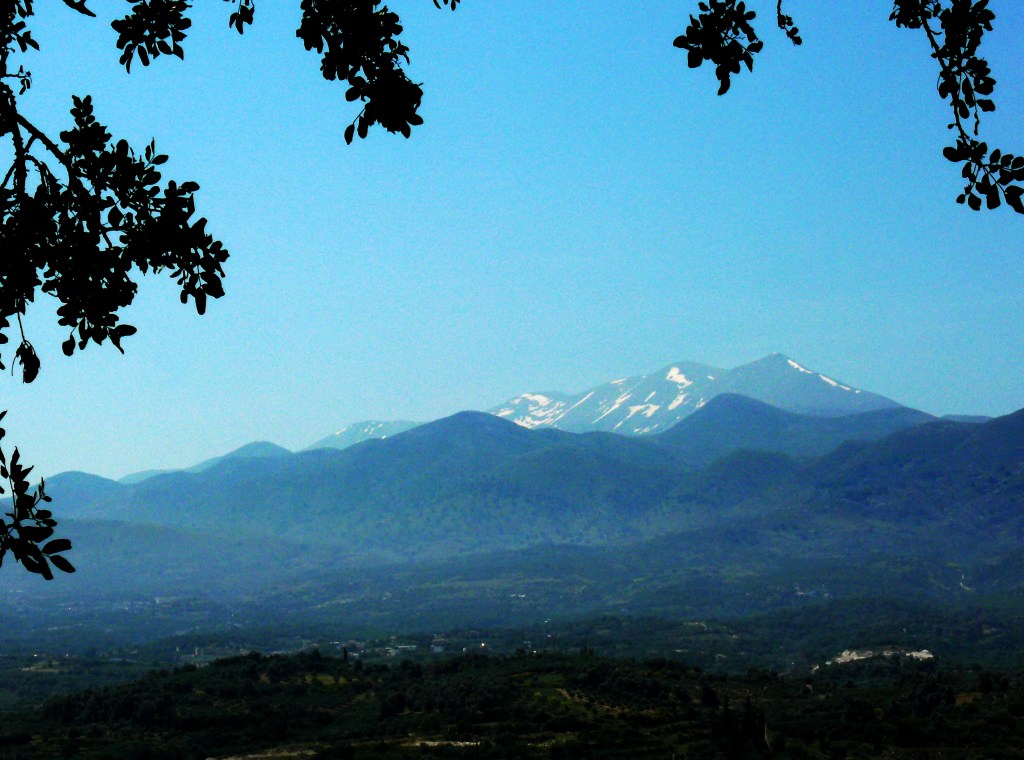
Mont Blanc from Lake Geneva in May.
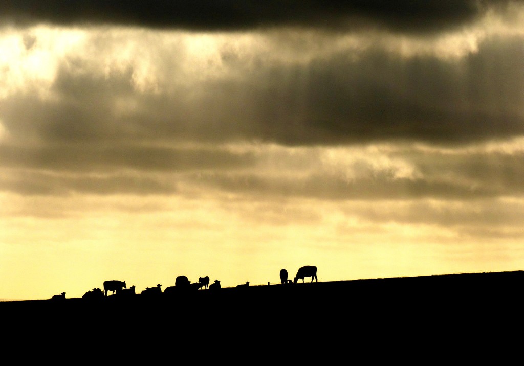
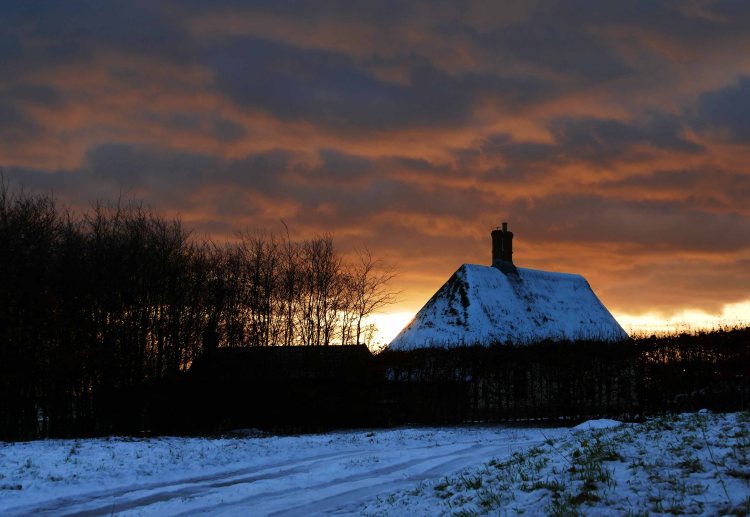
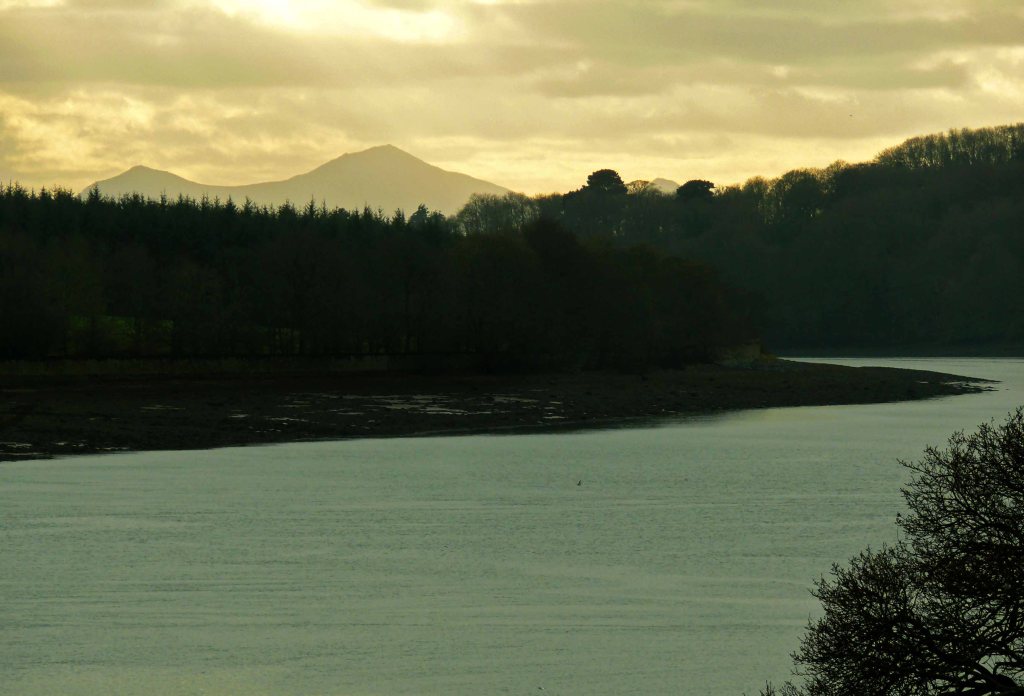
Back down near sea level the parallel crosses the northern plains of Italy, which again are hot and sunny in summer but can be plagued with freezing fog in winter. On the coast is Venice which throughout the Middle Ages was a strategic link as the Mediterranean’s most northerly port it traded between the hot dry Middle East and the lands of the north beyond the Alps. Continuing east the line follows the course of the River Sava and lower Danube to the Black Sea, which in classical times was seen for centuries as the border between the civilised Mediterranean cultures of Greece and Rome and the barbarous Germanic tribes of the north. The parallel then crosses the Black and Caspian Seas near their northern ends. Significantly north of this latitude the seas can be expected to freeze over in winter while further south they remain clear. Nowhere is this more apparent than the Crimea. This virtual island jutting out into the Black Sea has a balmy Mediterranean climate on its south side facing the sea and a rigorous steppe climate on its landward northern side. This southern ice limit is repeated where the parallel crosses the sea separating frigid Russia from the snowy island of Hokkaido and again off Newfoundland, where it crosses the notorious iceberg alley, made more dangerous by fog banks, close to where famously the Titanic came to grief.
East from the Caspian Sea is the fast diminishing Aral Sea. Here we find the most extreme weather yet. It is a desert which is searingly hot in the summer and bitingly cold in the winter when hit by an icy blast from Siberia not far to the north. Siberia is home to the world’s largest forest and to the south of the 45th parallel the land is mostly desert but roughly along it, stretching both east and west, is the narrow band of grass steppe. Further east the terrain becomes mountainous with the Ili Valley just to the south of the parallel, the last fertile region for some distance, and to the north are the remote and desolate Dzungarian Gates on the border of Russia and China.
The parallel then continues over the bare windswept mountains of Mongolia constantly overlooking the border of China someway to the south. These mountains are the source of a number of rivers whose waters flow north across the vastness of Siberia while to the south the mountains merge into the Gobi Desert stretching east along the parallel and is also a boundary between the fertile and populous plains of China liying just behind its Great Wall and empty arid Mongolia. Further east though the Manchurian part of China does cross north of the 45th parallel at Harbin but in winter this is known as the freezer of China much as Minnesota standing on the same latitude in the American midwest is known as the freezer of the U.S.
Where the 45th parallel crosses the Pacific it leaves Asia by passing over the stark volcanic Kuril Islands plagued by drift ice in the winter and fogs in summer but where the parallel makes landfall across the ocean in America the moist and mild influence of warm ocean currents create good growing conditions in the favoured and fertile Willamette Valley protected by a coastal mountain range from the full force of winter storms. After crossing the valley the parallel keeps close to the mighty Columbia River before crossing over the Rocky Mountains to follow the long southern border of Montana, whose climate has more in common with Canada than the U.S. but with all these places that suffer severe winters they also have hot if sometimes brief summers. Snow is the other factor of cold in the mountains of Wyoming just south of Montana, Maine which straddles the 45th parallel in the eastern U.S. and just to the south of this line of latitude around Buffalo all are famous for prodigious amounts of snow. The mighty Niagara Falls just north of Buffalo can also spectacularly freeze over as will the Great Lakes during a hard winter with the 45th parallel crossing Lakes Michigan and Huron.
Finally the parallel crosses the Atlantic to close the circle on returning to France but here is found the biggest anomaly of all. The line first passes through Halifax, which has the distinction of being the only major year round ice free port on Canada’s eastern seaboard. On the other side of the Atlantic however the North Atlantic Drift, which is the northern extension of the Gulf Stream, keeps the European coast ice free throughout the year well to the north and east of Norway’s North Cape at a latitude of 70 degrees. For early explorers going as far back as the Vikings this must have been very confusing but to no one more than the famous English explorer Henry Hudson on his final and fateful voyage in the early 17th century.
Having already explored the high arctic beyond Norway and rediscovered Spitsbergen (Svalbard) he was commissioned to search for the Northwest Passage. He was successful in discovering the entrance to Hudson Bay and sailed south in search of an exit not knowing that it was an enclosed bay. Unfortunately winter was closing in, but by the time he had reached James Bay at its extreme southern end he had reached the same latitude as London and must have thought that winter should not be too severe there. He could not have been more wrong, his ship was locked in ice until June and on being released his crew mutinied and cast their captain, his son and a few other officers adrift never to be seen again. He was only the first of many explorers to underestimate the extreme cold of the Canadian Arctic with the tundra stretching as far south as the 55th parallel and the possibility of spotting a polar bear this far south when the sea freezes for half the year. Yet the anomaly does not lie so much with Canada but more with the Gulf Stream keeping the western fringes of Europe unusually warm for their latitude. As described below this influence can fluctuate over periods of time, with Europe having passed through regular cold phases in the past.
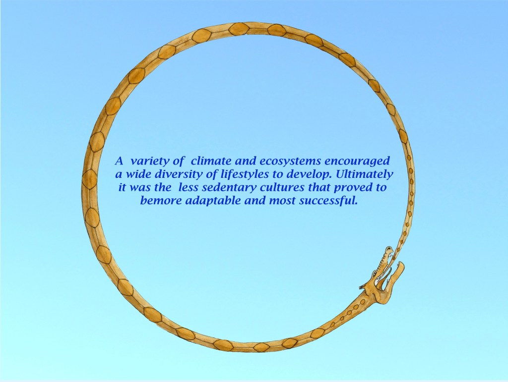
A post Ice Age climatic optimum several thousand years ago encouraged tribes, whose numbers had swelled in the fertile valleys of the southern Caucasus, to cross over the mountains and move north along the fertile land corridor between the Black and Caspian Seas. Steadily pressing on further north they discovered wide fertile grass plains stretching far to both east and west. They had ventured well beyond the 45th parallel but they would have been blissfully unaware of this, though they quickly found winters to be much colder than they had been used to. They needed to adapt or ultimately perish, but this they did showing a huge amount of flexibility and ingenuity to become some of the most inventive and successful tribes of this formative period in human history, which would set the stage for a modern world that we recognise. They had one great handicap which was the lack of raw materials like metals but these were available in the surrounding mountains which they acquired by either raiding or trading.
They were renowned for their mobility thanks to being the first to domesticate the horse and later this was enhanced with the invention of the wheel allowing for the first horse drawn vehicles soon to be followed by the development of the chariot. With these advantages they were able to spread far and wide; even beyond the steppes and into quite different habitats. Some returned south over the mountains and were able to take over lands richer and more populous than their own. Some others moved further north following long fertile river valleys which stretched deep into the forested hills of the interior. Here they learnt of other rivers flowing into a large inland sea to the west where there was talk of lush pastures. These folk were principally cattle herders relying on meat and milk, the latter of which they had learnt to turn into other longer lasting products like butter and cheese which they had evolved to tolerate.
Like their southern counterparts along with their mobile lifestyle they had also adopted a mobile form of warfare with fast surprise attacks on horseback for which their opponents had little answer. They were thus able to sweep across the land taking control over large areas of the North European Plains all the way to the Atlantic. Many settled around the Baltic Sea and its many rivers opening up the area to cattle. The winters were no colder than on the steppes and they had greater means to avoid the wind with the shelter of trees and timber to build sturdy shelters and provide fuel. It was mainly the summers that were different for sometimes they could be cloudy and wet. Here there was also the opportunity to trap or hunt for furs and there were plenty of fish in the sea and rivers but their biggest bonus they discovered was precious amber with which they could trade for necessities like metals.
Again they had adapted successfully to their circumstances and during the Bronze Age they flourished but steadily the climate worsened with the drab wet summers beginning to predominate and occasionally having to suffer the harshest of winters which would freeze over the sea and dragged on into Spring so that the sea and rivers might not thaw until after the swallows arrived.
Sand Martins.
The 55th parallel which passes close to the border of Denmark and Germany and then close to the southern Baltic coast is significant in that north of this latitude for two months of the year or 60 days of mid winter the days are less than eight hours long or looking at it another way the nights are twice as long as the days. At this time of year the sun rises in the southeast and sets in the southwest with a trajectory of just 35 degrees above the horizon, it hangs very low in the sky all day. This trajectory remains the same in mid summer but with 16 hours above the horizon and rising in the northeast and setting in the northwest it has plenty of time to climb high into the sky. During the summer solstice the sun is only about ten degrees below the horizon at midnight and looking north across the Baltic the sky does not turn fully black with a faint blue glow persisting along the horizon. It is no wonder that all these facts and co-ordinates were a fundamental part of their religious beliefs and from earliest times they and the luna cycle had been calculated precisely.
Solstice Afterglow at 10pm.
All this means is that as with the 45th parallel where seasonal temperature extremes are a feature then on the 55th parallel the main feature is sunlight or lack of it. In both cases but more so with the more northern parallel the amount of cloud cover has a dramatic effect on temperatures so that a sunny summer will be warm and ripen crops quickly while clear skies persisting through winter will allow temperatures to plummet. In winter Atantic storms penetrating far inland would bring heavy snow falls but in summer persistent cloud and rain would not allow crops to ripen.
This scenario is close to the climate of Scotland where maritime influences predominate giving the country mild wet winters and cool dull summers, which is in contrast to Latvia which lies on a similar latitude but more exposed to continental influences giving warmer summers but much colder winters. All lands in between are gradations of these two extremes but the climate has always oscillated so that sometimes maritime weather predominates and at other times continental weather takes over. At the moment the climate is in a maritime phase fueled by a strong jet stream especially in winter pumping mild air even into the Baltic. This can easily change as during the Little Ice Age, which lasted through several centuries up to the mid 19th century. Then there were many exceptionally cold winters when even in England frost fairs were held on a frozen Thames in London. The coldest years could reduce the growing season by a month in northern latitudes down from six months to five. This 17% reduction in productivity would not only impact on yields but create the need for extra provisions to last the winter and the gathering of extra fodder to keep livestock fed during this time. Without outside help this would push whole tribes living in marginal areas over the brink forcing them to move south thus putting pressure on other tribes.
There were also cold periods either side of the height of the Roman Empire, a period lasting around 400 years when the climate remained generally benign. Without the conveniences and science of the modern world folk back then had to adapt as best they could but extreme weather events would also in time alter their world view, especially in the more northern latitudes. They found themselves struggling to live in what had become a forbidding environment of stormy skies, dark forests and icy waters. Warm south westerlies had been replaced by bitter north easterlies and furs were becoming harder to procure. They spent long winters huddled around fires passing the long dark hours telling stories and trying to explain to the younger members of the tribe how things came to be so. At the same time on the eastern steppes there were episodes of drought which forced the tribes there to move west in search of greener pastures causing those on the western or Pontic steppes to also drift west putting pressure on the forest tribes. This added pressure was enough for these tribes to push south and even break through into the Roman Empire at a time when its might was already waning.
The situation reached a low point around the mid sixth century when the weather turned exceptionally cold for a number of years with outbreaks of the plague in southern cities travel was difficult and dangerous causing long established trade routes to collapse. For several years northern tribes found themselves isolated in a climate not fit for man or beast. The weather did slowly improve with occasionally good autumn harvests returning, less severe winters to endure, more promising springs to lift the spirits and brief bright summers in which to recover, though overall it remained changeable and unpredictable. In such trying circumstances hope hung on little things. It taught folk to make the most of any positive sign to help keep them going through the dull days and cold nights.
In higher latitudes it was very much the case that weather could lurch to extremes of both good and bad. When it was good it was beautiful, the greens were fresh and the flowers vivid in Spring and summer days could still be balmy lingering long into evening. Autumn would put on a fantastic display of colour and even clear still winter days were invigorating. Nothing was taken for granted and nature and the weather was watched closely for signs that might predict changes, which was the only constant. When the first cold blast might arrive, when the ice might finally thaw, will the cold winds ease and will the weather hold long enough to bring in a successful harvest. They watched the comings and goings of the mass flocks of migrant birds, the rise and fall of rivers, the first and last frosts, the behaviour of insects and other creatures and the moods of an ever changing sky.
Weather patterns only began to be understood in the second half of the nineteenth century with the introduction of the telegraph which allowed weather information to be reported instantly from distant and even remote places. This enabled a picture to form of how big a storm was and which way it was moving. Before this no one knew if a storm they were experiencing was a local phenomenon or whether it stretched across the country. It took another century for forecasts to confidently predict weather more than a day ahead thanks to an array of satellites having been put into space during the last quarter of the twentieth century to watch storms develop far out to sea. Today powerful computers can even predict general weather patterns before they have even formed.
All our ancestors could do however is construct a whole folklore around natural phenomena and this in time became the basis of a uniquely northern religion with roots and a purpose quite different from those that evolved by people to the south of the 45th parallel in the fertile oases and rich cities. They looked north and judged its inhabitants as barbarous and called them heathen forgetting that some of them had originally come from there and that many innovations and inventions took place there. This was dangerous and in time they would suffer from underestimating their tenacity and adaptability. This inventiveness was based on their close link to nature and showed first in their artistry but would ultimately lead to much more like sleek ship design and advanced weapon making. Again as in the early Bronze Age they had developed a type of raiding warfare that their opponents had no answer to but this time it was sea borne rather than on horseback but the parallels are clear to see.
Their first priority after the extreme events of the mid sixth century though was to re-establish trade routes. In reverse to their early Bronze Age migration routes of the Bronze Age they ventured south down the long rivers of the interior to emerge by the Black and Caspian seas from where they could easily access the great cities of the south. Sometimes this meant fighting their way through hostile lands causing a reputation to spread before them of being marauders. This would make it more difficult to negotiate safe passage and trade deals, which was also the case when they ventured west by sea in their sleek versatile ships that could cross oceans or as easily sail far up rivers shocking the local inhabitants when they appeared without warning.
Another handicap is that during their isolation the world that surrounded them had become fiercely and uncompromisingly Christian, and having had to deal with Muslim incursions as far north as the 45th parallel, this made them immediately hostile to what they perceived as a pagan threat. The heathens meanwhile found undefended and exposed monasteries easy pickings with interiors encrusted in precious objects which had no relevance to them other than as bullion. Rather than mindless heathen marauders they were motivated by loyalty and honour to improve standards for their loved ones back home who had been barely subsisting for decades.
Even now when we look back peering deep into the past we have difficulty understanding their motivations often judging them as ignorant folk stumbling through a great tract of northern wildwood. Our view was prejudiced early on by how the Romans and other literate societies regarded their non literate and non urban counterparts. Yet buried in books or listening to biased sermons one can become divorced from the natural world and what it can teach you. The real truth is that you never stop learning and discovering new things once you are immersed in an environment rich in diversity. All you have to do is look – up, down, under, over, near and far but most of all early and late. Those locked into a 9 to 5 world are only living half lives failing to see the vast range of beauty the natural world has to offer.
Living close to the 45th parallel is generally the best place to witness the steady change of the seasons which seem to go at just the right pace to enjoy them fully, especially if you are an outdoors type of person. For each season there is something to look forward to. This can be a refreshing outdoor swim on a hot summer’s day, a misty autumn day spent foraging in tinted woods and along laden hedgerows for mushrooms and berries, in winter a brisk long walk crunching through frosted snow and long shadows and best of all when spring arrives witnessing the return of a warm sun encouraging the land to burst into bloom with the most vivid and vibrant colours of the year. These are experiences our ancestors could also have enjoyed but in quite a different context. Where we might quickly move on to another type of experience for our ancestors this would be as good as it got and would be absorbed and cherished the more so for it. Perhaps more than anything we are guilty of not lingering and should remain in the moment instead of always planning ahead.
To experience the best nature has to offer it is necessary to be up before the sun and linger outside until after it has set. In northern latitudes this is easy in winter but takes commitment during the long summer days but is most rewarding in spring and autumn. These are times of the year when not only the countryside is changing day by day but the weather is changeable too. It can easily jump back and forth between winter and summer each time the wind changes from a gentle breeze wafting up from southern climes to switching suddenly to a chill northern blast. One of the greatest boons of modern technology is having devices to tell us what the weather is going to be several days hence and with the same device locating somewhere nearby where conditions are best favoured for appreciating the latest spectacle that nature has to offer.
The major challenge is that in the mobile and informed world of the 21st century unspoilt natural places can be hard to find and the obvious ones can be busy. This is another reason for going out early or late and not looking for the obvious but seeking out the subtle. If you are fortunate certain conditions might occur that connects you briefly with a time when nature still held sway over man. Even though I live in an area where the land is intensively farmed there are still places that have yet to come under the plough and if lucky with views where there are no obvious modern intrusions to spoil the mood and break the spell of stepping back into an unspoilt world. The sequence of photos that go with this post are nearly all taken in the same area, between latitudes 53 and 53.30 degrees north, where farming is an industry which demands large vehicles working huge fields in a constant cycle of production to feed a constantly growing population. Only precious pockets of unspoilt or protected land remain such as old pasture, ancient woods, untamed rivers and wild coast. Occasionally man can still be in harmony with nature as in the case of areas of woodland pasture or old byways where thick hedges can grow. Given a chance nature will seize opportunities to flourish as along wide grass verges or abandoned quarries or gravel pits. All untended places are worth exploring because nothing is more opportunist than nature.
A good indicator of finding somewhere unspoilt is sound. There should be plenty of natural sounds like bird song, rustling leaves and running water. Cattle lowing and the bleating of sheep are acceptable but the noise of traffic even if it is a distant background hum is not. Today this noise is so omnipresent that we unconsciously block it out. When crossing a busy road with cars passing at the national speed limit you then understand why the sound travels so far and why it is so frightening and disorientating for wildlife.
Today a recognised indicator for the health of the countryside is by counting species or the size of flocks but in the past this would have been regarded as absurd. The size of flocks back then could be so large that they would be impossible to count unless it was to the nearest hundred or even thousand. While the sky back then might have darkened due to clouds of birds passing overhead there were also times when waters would erupt with life and boil with activity. During salmon runs rivers would seem to be alive with fish and herring shoals just off the coast would be in their millions. Both would attract large predators with bears and eagles along the rivers and large marine mammals and tuna attacking the herring with humans also struggling to get their share while being dive bombed by gannets. The course of rivers would be determined by beaver dams rather than human ones. The former encouraging diversity and the latter blocking it.
Now domesticated animals dominate the world all of which are counted in billions. This includes both animals to eat and pets to entertain us. For every human on the planet there needs to be a field full of animals to sustain him. This is why space of any kind is at a premium and in a human dominated world wild space is diminishing fast. Even the skies are crowded with jets. So finding places without vapour trails overhead is the most difficult of all.
With all these considerations it is best to find a deep wooded valley with a clear stream flowing through where you can hear only small sounds and concentrate on the mosaic of details that surround you or by contrast a remote exposed stretch of coast where the elements are still in charge with the roar of the sea and purgative effect of the wind and the liberating sense of wide open horizons can recalibrate your view on life. Don’t however wait for a nice warm afternoon to do this but go on moody days such as cool stimulating misty mornings, afternoons that threaten a storm and a post storm evening when the rain has cleaned the air promising a coal black star filled night sky.
You often can tell when you have found a good place because there are no straight lines to be seen. This includes no forest rides which allow vehicle access. In the original wildwood even paths would not be straight because of the barriers formed by fallen ancient trees, boggy ground and tangles of thorns. All these things seem problematic to the modern mind but to wildlife they are essential cover where they can carry on their lives largely unseen.
We as intruders have a duty to pass through largely undetected leaving little or no evidence of our presence. Moving silently we might be gifted with glimpses of the wild, which our ancestors were so familiar with but it is still distant in many ways from their experience. Not only would they see more but more importantly they were able to read more about what they saw. Theirs was a multi sensual three dimensional reading of their surroundings much more compelling than any immersive computer game yet to be devised.
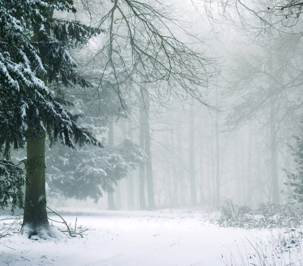
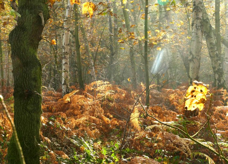
At the mid latitude of the 45th parallel the trees, except for in the mountains, are mainly deciduous, an adaptation that evolved specifically to cope with seasonal extremes. They shed their leaves in autumn to remain dormant through the long winter. North of this latitude at this time wildlife has to decide how best to cope. Many birds migrate to warmer climes, some mammals from bears to bats fatten up to slumber through the coldest months, while insects seem to totally disappear only to reappear miraculously in spring. We are able to turn up the heating and carry on but this has only recently been the case.
If you lived on or above the 45th parallel a thousand years ago and had a disappointing harvest then your main concern would be – was there enough food to last the winter? Keeping warm would be a constant chore having had to create a huge log pile even before winter started. Lighting would come mainly from a central fire with maybe a few flickering candles to aid specific jobs like needlework. Trips outside would be regular with plenty of pee holes in the snow surrounding the dwelling. All the while at the back of your mind would be the thought that if elsewhere conditions were worse come Spring would these people in desperation raid your meagre rations or remaining livestock. Spring would bring relief but also hard work to a weakened body. Only after harvest would there be a brief respite before preparation for winter would start again and the further north you lived the smaller this window would be.
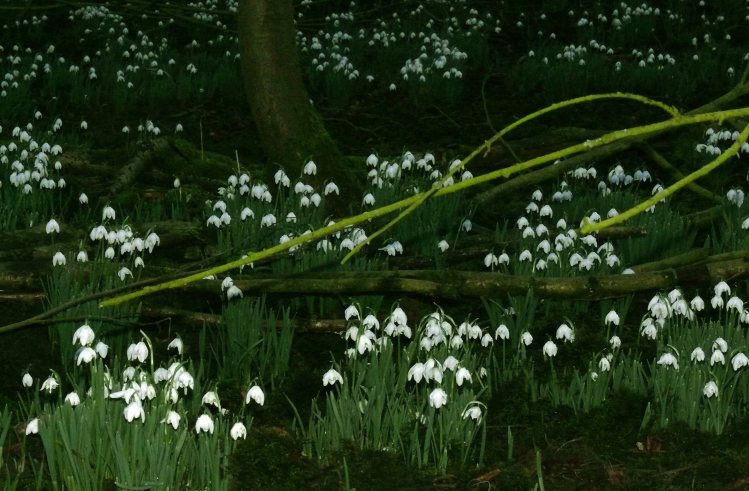
While today we have the advantage of checking the weather before planning activities whether for work or play and adjust them accordingly depending on the forecast, maybe grumbling if a little if rain was on the way, our forebears would be watching every sign available to them looking for patterns to the seasons. This weather lore would not only involve watching the skies but also for any other clues that nature might offer. In Spring this might include when toads start their mass spawning, the steady return of migratory birds and the flowering or leafing of trees, shrubs or flowers. This would be a concern right through the year keeping a close eye on the changing seasons in anticipation of different events and challenges. It was an all consuming and integral part of life with folklore evolving and the telling of stories of extreme years and any portents there might have signalled the possibility of a hard winter, wet spring, summer drought or stormy autumn. During turbulent times of extreme weather they would also call on their gods to intervene and spare them from such hardship.
Even today with regards to insurance policies we still refer to “an act of God” which shows how recently we believed that such things as weather were due to divine intervention. Yet most modern religions put man at the centre of all things. This human centric view evolved in urban settings and with religions remaining very centralised, dogmatic and hierarchical they changed little over time. The intolerance of some Christian societies was clear to see at the beginning of the Age of Exploration when it was first realised that heathens across the world outnumbered Christians with a reaction among the ruling elite that this statistic should be reversed by whatever means necessary, which in some cases would have shocked a hardened Viking warrior.
The Spanish conquest of the Americas had parallels with the Viking attacks on western Europe. The first phase was looting the religious treasures of the Aztecs and Incas and melting down works of art into bullion followed by settling large areas that were good for European type agriculture and using slaves to increase their productivity and profits. When Europeans suddenly appeared in the Indian Ocean at the end of the 15th century, which had been an almost exclusively Muslim sea for centuries allowing them to control the spice trade, it must have been similar to the first Viking raids at the end of the eighth century in Europe. With the parallel that in both cases during the next two centuries these isolated attacks escalated into wholesale invasions.
The Reformation in the 16th century followed by the religious wars across the northern half of Europe in the 17th century were based on a rejection of the centralised and dictatorial form of Christianity that had held sway over Europe during the Middle Ages. In the early part of this period this hierarchical system conveniently tied in with the formation of nation states under a single ruler but as feudalism loosened its grip on Europe with the growth of towns and cities run by an emergent and literate middle class this orthodoxy was inevitably going to be challenged.
The old catholic orthodoxy had least relevance in the northern half of Europe and had been embedded there for the shortest amount of time. It had taken many centuries from the end of the Roman Empire to slowly convert these northern lands to Christianity. To begin with there were successes thanks to the preachings of at first Irish then followed by Anglo-Saxon itinerant monks, but the bullying tactics employed by Charlemagne set back this conversion by a couple of centuries. It was not until the 12th century that remote parts of Europe around the eastern Baltic were finally converted. It is not surprising then that Scandinavia and northern Germany not only were the first to embrace Protestantism but today have also embraced the new environmental revolution. Maybe this has to do with a faint lingering resonance of the old natural folk beliefs that had been prevalent in the north.
Animist and folklore beliefs have always been more localised, rural and flexible and believe in a much closer association between man and the natural world. Today science is finally beginning to reveal that we are not only closely linked with nature but that our recent actions are responsible for upsetting its balance. This will not only impact on nature but our own well being. It is clearly time to reverse the mistakes we have already made and revere nature once more by creating large sanctuaries of wildwood and untamed heathland for key species. Rewilding and the reintroduction of apex predators to return a balance to nature, as has already happened in Yellowstone N.P. should also be on the agenda. If we are not ambitious about helping nature to help us then not too far in the future when the impact we have inflicted on the planet becomes irreversible we might find ourselves back on our knees and praying for deliverance.
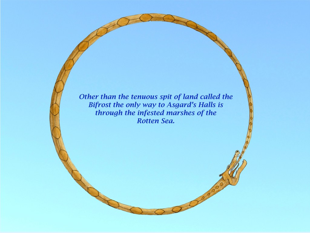
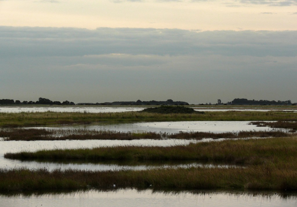
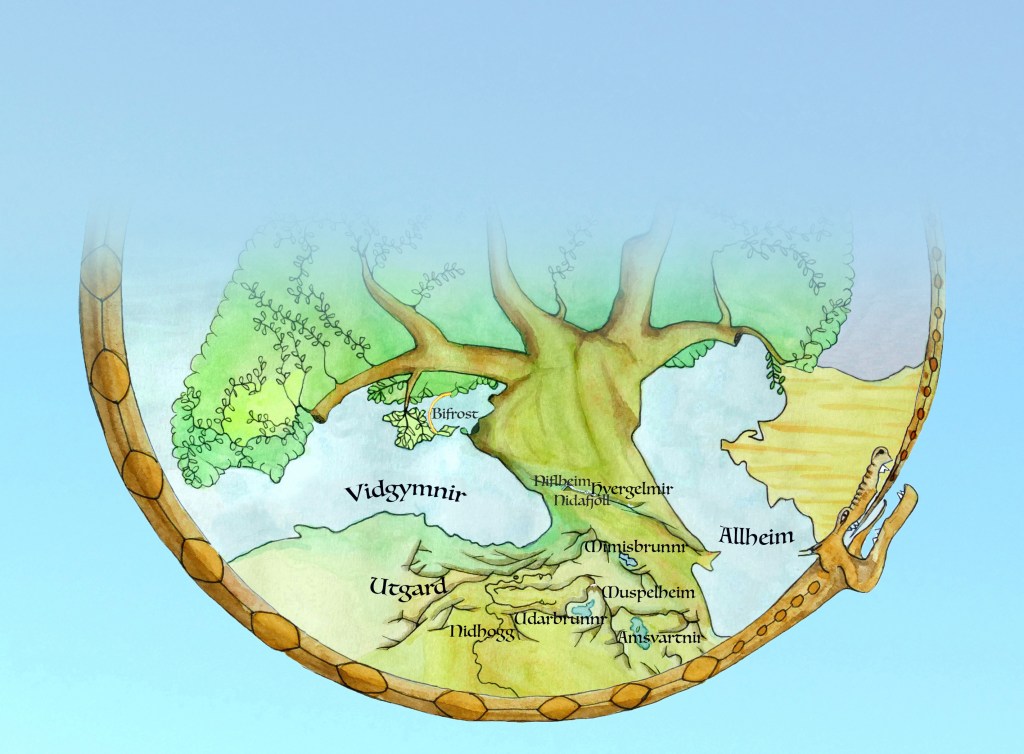
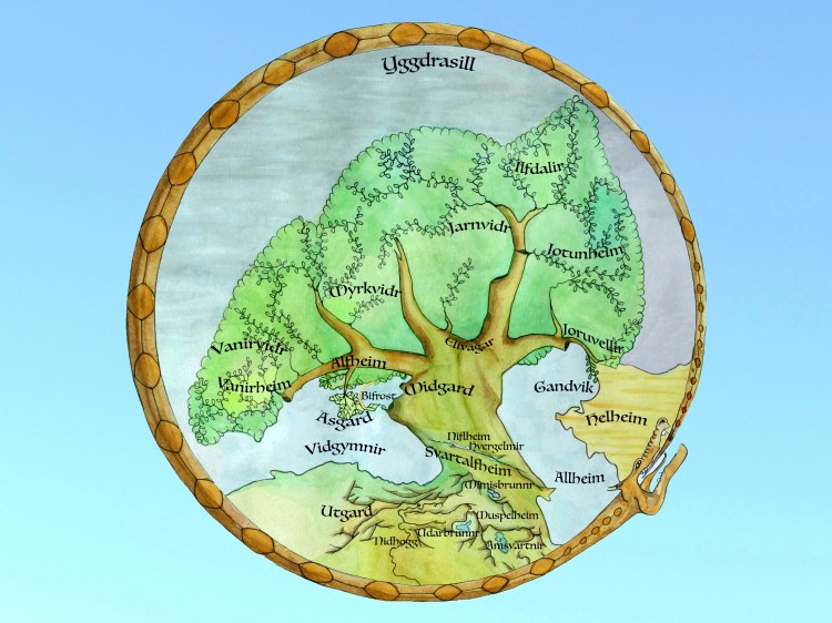
Other than crossing the exposed and precarious Rainbow Spit (Bifrost) the alternative entry into Asgard is to negotiate a maze of marshes and lagoons of the Rotten Sea. This inhospitable terrain, frozen in winter and malarial in summer, wraps around the north and east edges of the peninsula making it a virtual island. Beyond this barrier of reed fringed salty lagoons the land is depressingly similar to that left behind on the mainland – a flat and featureless expanse stretching as far as the eye can see across many leagues of windswept steppe. When it eventually starts to rise it meets a thick forest. This cloaks the northern slopes of Long Ridge, which stretches east and west without a break, and ultimately rises to a towering crest overlooking the deep blue expanse of the Wide Sea a kilometre below. On this remote and rugged ridge the Aesir chose to build their halls from long beams of cedar wood and large blocks of golden limestone both found along this lofty crescent ridge. Most of the time they remain hidden from mortals wreathed in mist produced by the moist mild maritime air mixing with the cool dry winds from off the plain but it is a unique vantage point from where, with their divine vision, they are able to observe most of Middle World.
Long Ridge shrouded in clouds.
Most closely connected to the Aesir are the Light and Dark Elves (Svartalf). They are just across a narrow strait to the east of Asgard where the Great Mountains rise directly out of the sea. Beneath their steep southern slopes are a labyrinth of deep caves occupied by the Svartalfs or Dwarves who are skilled in metal work. On the less severe northern flank of the Great Mountains is an extensive forest rich in a diversity of wildlife and is also home to Elves who share metalworking skills with their darker cousins over the mountains but are also careful custodians of the land as they and steeped in forest lore.
Beyond these two inhabited regions The Great Mountains rise high above the forests into a cold primordial world of rock and ice wreathed in clouds and is called Niflheim. This is the highest point in Middle World from which many rivers flow in different directions down to the two seas. The only other place that reaches similar heights is Muspelheim away to the south. This cone shaped mountain though is an isolated peak, which towers above the highlands that surround it. It is a huge volcano that seethes restlessly emitting steam and spitting out hot rocks and threatening to fully erupt at any time.
To the west of Asgard many large rivers enter the Wide Sea across on the mainland. They begin their long journeys in the distant mountains in the extreme west. Though these mountains are not as high as the Great Mountains to the east they nevertheless have deep valleys cut by many rivers and their steep slopes are clad in forests of tall beech trees and are known as the Deep Dales. In the fertile valley floors, obscured from the Aesir, live an ancient and sophisticated race called the Vanir who rival the Aesir in their knowledge. In the far north, beyond the Great River, is a distant pine forested mountain range where another quite different race live called the Jotun. They are giants and too rival the Aesir but in strength. They have mineral wealth in their mountains and the extensive northern forests are home to large beasts, which the Jotun hunt and by using forest lore sustain themselves through the long cold winters.
These dark remote forests stretch for countless leagues in every direction except south, because here are the open grasslands of Midgard that stretch between Jotunheim and Asgard and is where mortal men live. They spend their short brutal lives toiling on the bleak windswept steppe. Yet they are watched closely by the Aesir from their lofty halls, which overlook the plains, because although they spend their short lives struggling and fighting they are inquisitive and adaptable and the Aesir fear that one day by acquiring new skills they will spread like a plague over the land and occupy all the lands of Middle World.
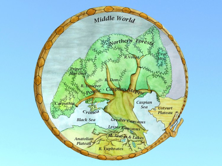
Niflheim, the first of the nine worlds is a land of frost and fog. This coldest of places is associated with the ice cap on summit of Mount Elbrus
Muspelheim is a hot burning place and home of the fire giants ruled by Surtr associated with the active volcanic peak of Mount Ararat.
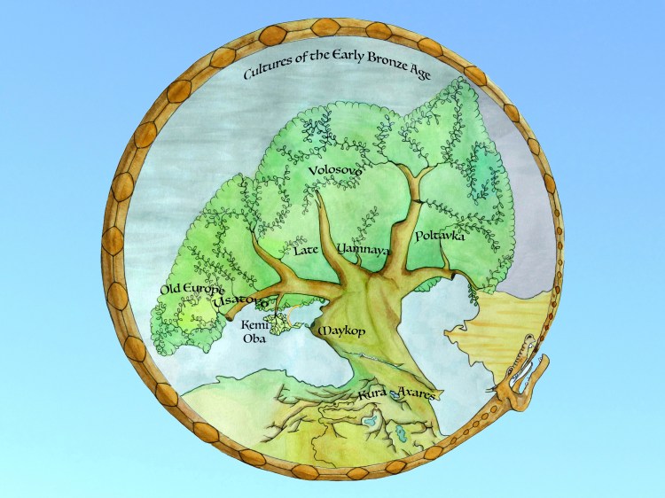
Midgard or middle world is home to humans and connected to Asgard by the rainbow bridge of Bifrost. (The Late Yamnaya Culture of the open Pontic Steppes)
Asgard home of the Gods and Goddesses in the middle world but separated from the world of men. (The Kemi Oba culture on the temperate peninsula of the Crimea.)
Vanaheim is the home of the Vanir Gods who are old Gods and masters of sorcery. (The old Cucuteni Culture in the valleys of the Carpathian Mountains.)
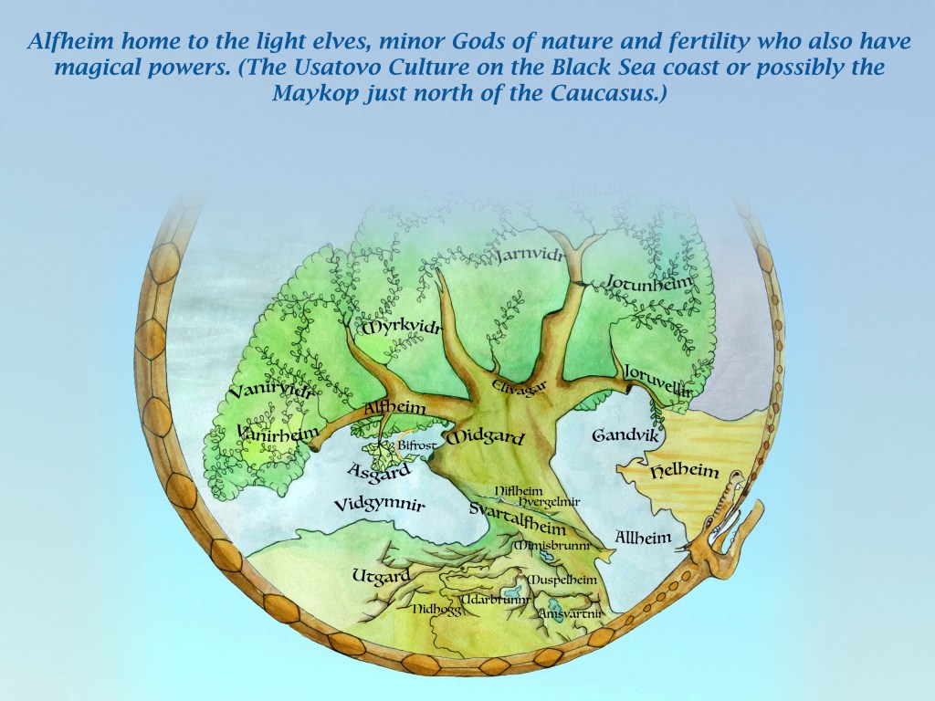
Alfheim home to the light elves, minor Gods of nature and fertility who also have magical powers.(The Usatovo Culture on the Black Sea coast or possibly the Maykop just north of the Caucasus.)
Jotunheim home to the giants who are enemies of the Gods. Their home is cold and remote. (The forests of the South Ural mountains.)
Svartalfheim is the home of dwarves or dark elves who live in caves and are admired for their craftsmanship. (The Kura – Axares Culture around the Lesser Caucasus.)
Helheim is home to the dishonourable dead. A desolate and joyless place. (The bare windswept Ustyurt Plateau and the baking Kara Kum Desert.)
Hvergelmir – The cold well of endurance. I have associated with a once longer Shkhara Glacier.
Nidafjoll – Dark and difficult to locate high mountains. I have associated them with a sheer wall of mountains, some of the highest in the Caucasus, immediately east of Mount Elbrus.
Mimmisbrunnr – The central well of wisdom. I have associated with the mountain waters of Lake Sevan surrounded by the Lesser Caucasus
Urdarbrunnr – The southernmost well of fate. I have associated with Lake Van, south of Mount Ararat.
Bifrost – The rainbow bridge. A tenuous connection between Asgard and Midgard. I have associated with the 112 kilometre long Arabat Spit (or Arabat Arrow) on the eastern edge of the Crimea.
Nidhoggr – the underworld serpent that gnaws at the roots of Yggdrasil. This is associated with the headwaters of the Euphrates River, which cut through the mountains west of Mount Ararat.
Amsvartnir – the barren salt lake with an island called Lyngvi where the wolf Fenrir is chained. I have associated this with Lake Urmia, which now is a fraction of its former size allowing its main island (Shahi Island) to become attached to the shore of the lake.
Utgard – the outer realm in the far south. The parched Central Anatolian Plateau.
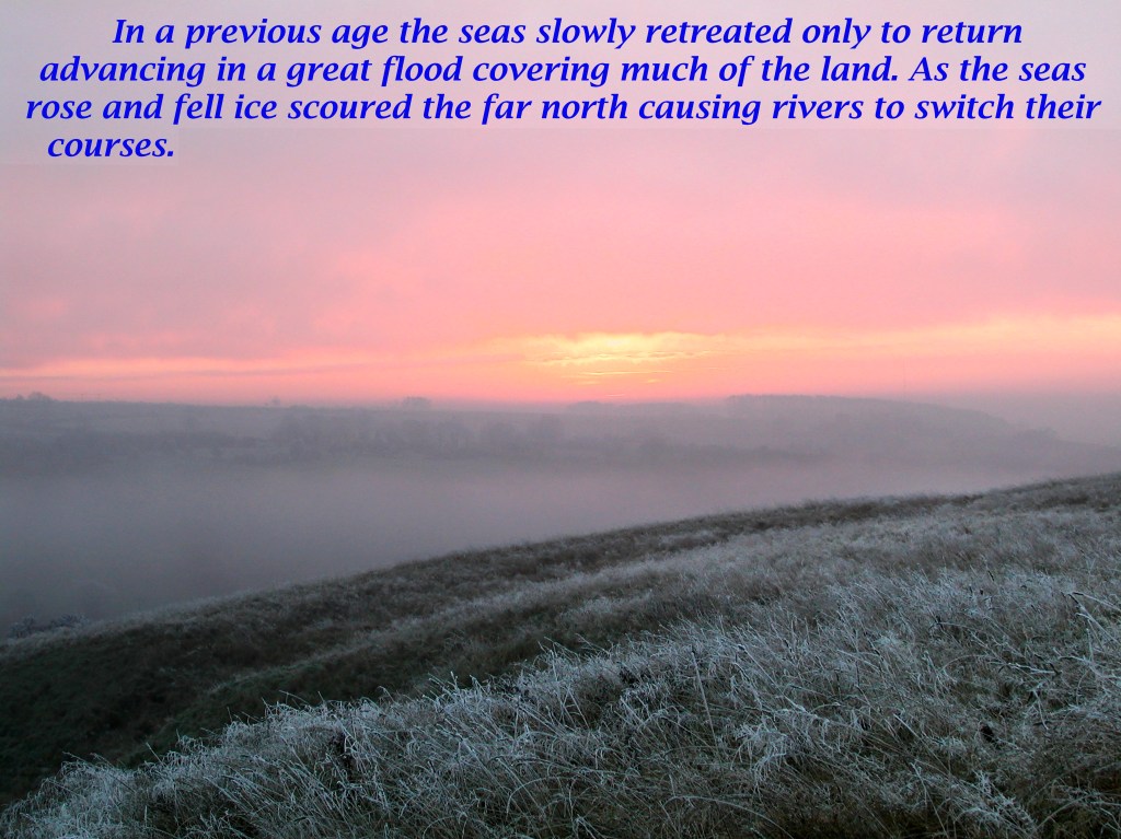
The seas had retreated during the deep cold but when the ice finally melted there were great floods. The retreating ice left lakes and meltwaters covering the land struggling to find a way to the seas which grew in size again until they over topped and flooded into each other. Stories passed down through the ages told of people spreading out over the world from the flanks of the great volcano after the flood.
During the coldest phase sparse grass replaced rich forest and desert dunes replaced grassy hills but when the great rivers flowed serenely once more, from a height their gently meandering courses looked like branches spreading across the bare plains. As regular rains returned new trees sprouted like leaves along their many branches slowly clothing the land in green once more. Away from the rivers the return of the rain was sufficient to allow fresh grass to reclothe the barren plains. Following this animals returned to graze and people were then able to exploit these vast roaming herds. It was the dawn of a new age – the age of man.
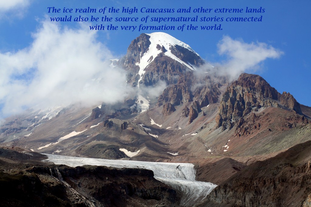
The cold and hot realms as described in the Norse creation myth are close to each other and the mixing of the of hot and cold and light and dark in Ginnungagap was where the world was created and Yggdrasil grew from a seed in Mimmisbrunnr. The cold realm therefore cannot be in the far north but in the highest mountains, which is why I have located Niflheim, Nidafjoll and Hvergelmir in the High Caucasus. The elemental nature of the hot realm is more contradictory and could be located in the desert to the east or the volcanic region to the south. I have associated Muspelheim, the home of the fire Gods, with the active volcano of Mount Ararat. It is equal in height to the High Caucasus but with relatively little snow and the two regions stand facing each other overlooking the the Lesser Caucasus that lies in between. It is in this range of lower but rugged volcanic mountains that I chose to place Mimisbrunnr, which I have associated with Lake Sevan. I chose to place Helheim however to the east just across the Caspian Sea in a barren land of sand, salt and rocks.
To understand their surroundings these simple yet adaptable steppe people would have had origin stories explaining where they came from, how the snowy southern mountains were formed and what lay beyond them in the exotic lands further south. These and the old civilisations on the fertile valleys away to the west would be a source of wonder to them. The skills of these older cultures in the earliest days of metalworking would have appeared to have been conjured up by sorcery.
During cold phases of the climate glaciers in the central Caucasus had scoured out deep valleys, bulldozing debris before them to leave lakes and be the source of many rivers. The endless dark forests of the north would have been the home of frightening beasts. In contrast the harsh arid lands to the south across the Caspian Sea appeared so hostile, baked by a merciless summer sun and blasted by icy winter winds, that it could only have been the home of evil spirits.
The one break in the ice wall of the central Caucasus, but only open for half the year, was the high pass of the Darial Gorge overlooked by the imposing bulk of Mount Kazbek. This led to the fabled land of wine (Georgia) possibly the Yamnaya’s first access to alcohol. Beyond this fertile land was a labyrinth of deep valleys overlooked by dark volcanic crags. In its centre rising above all this, that twisted round it like the tangled roots of an enormous tree, rose the huge snow capped cone of Mount Ararat. This active volcano, which erupted during the early Bronze Age, overlooks three great lakes partly formed from other ancient eruptions.
The Yamnaya in the early Bronze Age occupied the wide open grasslands between the Dniester and Ural rivers. Surrounding them were cultures quite different from their own. Some seemed older and more sophisticated living in large settlements and working metals others seemed less advanced living in forests as hunter-gatherers but all spoke languages that were fundamentally different from the steppe people.
The Yamnaya though only simple farmers were renowned as the people of the horse and the wheel. This was a formidable combination which would allow them, in time, to spread out from the steppes to colonise far off lands. Their presence was often marked by large burial mounds or kurgans standing out on the flat plains. Before this happened however they were probably in awe of the people who lived in the large settlements and daunted by the vast unbroken northern forests.
Close to the Yamnaya on the northern flanks of the Caucasus were a people we call the Maykop. Their expertise in producing early bronze items like axe heads would become crucial to the success of the Yamnaya. The Maykop, who lived close to some of Europe’s most specie rich forests, were able to produce an early form of bronze from a mix of copper and arsenic in reusable casts. This was in much demand even to people who were living in the urban centres far to the south of the Caucasus who had devised the world’s first pictographic script. Much closer to the Maykop, on the Crimea were people we call the Kemi Oba who were producing stela covered in pictographic symbols, which later are known to have spread along the northern shores of the Mediterranean as far as the Atlantic coast.
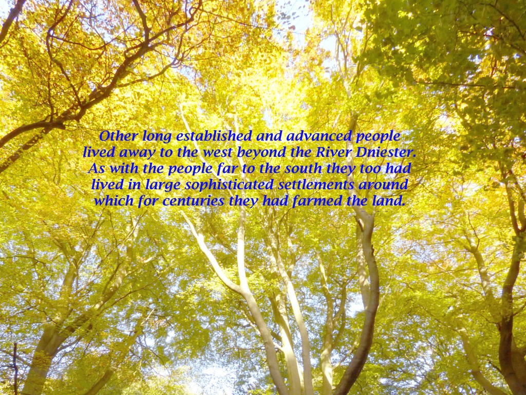
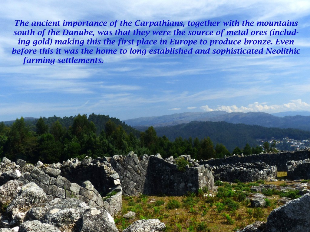
Another long established and sophisticated civilisation lived away to the west beyond the River Dniester. As with the people far to the south they too lived in large sophisticated settlements around which for centuries they had farmed the land. They also had access to precious metals like gold, silver and copper found in the mountains around them or from more distant locations up the Danube.
Despite only few people living in the northern forests exotic items such as amber, ivory and furs would emerge from them having been shipped many leagues along the great rivers when free of ice. In time even the Ural Mountains would become a source of the new sought after metals. The steppe people, who were restless and inquisitive, would over time infiltrate all these lands which surrounded them and learn and even adopt some of their ways including how to make and trade metals.
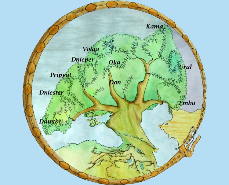
These new skills encouraged the Yamnaya to venture far and wide in search of new opportunities. Adapting to new farming methods such as dairy farming learnt from tribes around the shores of the Black Sea they then took these new skills and ideas with them as they pushed north along the Dniester and Dnieper rivers searching for new lands and opportunities on the plains of northern Europe where they found lush pastures along the Baltic shores.
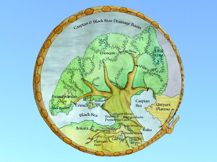
The Volga and Dnieper rivers drain a vast catchment area stretching from the Polish border east to the Urals. The Volga begins by flowing east until reaching the River Kama where it then turns to flow south. This major tributary is the first of many from the Urals that join the Volga which finally passes through a broad delta to enter the Caspian Sea. The Dnieper’s main tributary, the Pripyat, starts life close to the source of the River Bug whose waters flow in the opposite direction towards the Baltic.
This system of rivers creates a widespread network of highways, which is completed by the Don and Donet. These two rivers combine to flow into the Black Sea having drained the area left between the Volga and Dnieper catchments. These watery highways were exploited fully by the Vikings and are still important today but they were also crucial in the Bronze Age. This was an age when trading really took off and although this coincided with the domestication of the horse and the invention of the wheel, both were in their early stages and had yet to be perfected.
The lower Danube was not just a major highway but also the centre for Europe’s earliest copper production with metal ores, including gold, found in the surrounding mountains. This combination of fertile river valleys surrounded by rich resources also led to Europe’s first sophisticated culture living in large stable settlements. These densely packed villages must have seemed solid and imposing to the more mobile steppe cultures of the time and their ability to produce metals and other refined products like pottery would have made them appear to have magical powers.
These long river highways would also have aided the movement of people whether caused by warfare, climate change or simple opportunism. The recent breakthrough of extracting ancient DNA is quickly allowing a picture to emerge of large scale folk movements in the early Bronze Age along the main river valleys such as along the Danube to the Hungarian Plains and from the western Pontic Steppes to the shores of the Baltic via the Dniester and Bug Rivers.
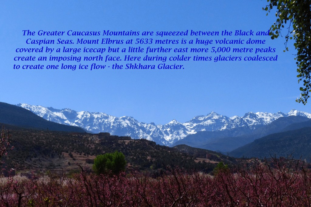
The Greater Caucasus Mountains are squeezed between the Black and Caspian Seas. Mount Elbrus at 5633 metres is a huge volcanic dome covered by a large icecap but a little further east more 5,000 metre peaks create an imposing north face. Here during colder times glaciers coalesced to create one long ice flow – the Shkhara Glacier. The western flanks of this great range are covered in forest, which shelter species lost to the rest of Europe.
The Lesser Caucasus Mountains.
The Lesser Caucasus further to the south are a range of 3,000 metre plus peaks, which surround the remote state of Armenia. This ancient Christian kingdom, now diminished in size, itself surrounds the beautiful Lake Sevan and its capital, Yerevan, is overlooked by the active volcano of Mount Ararat (5165 m.). In between the Great and Lesser Caucasus is squeezed the ancient land of Georgia famous for wine and some of the deepest cave systems in the world. There is even a cave city and near the shore of the Caspian in Azerbaijan, north of Baku, there is a fire mountain fuelled by natural gas seeping out of rocks. This republic facing the western coast of the Caspian is quite different in appearance from Georgia in that it gets only a third of the rain of the Black Sea’s east coast.
The Ural Mountains
The Ural Mountains extend from the Arctic Sea down to a latitude equal to London. Mount Yamantau (1638 metres) js the highest peak in the southern half of this long narrow range. Here is thick forest with many rivers whose waters ultimately flow into the Caspian. The northern half of the range is mostly tundra and faces frigid Siberia to the east beyond the mighty River Ob.
Carpathian Mountains
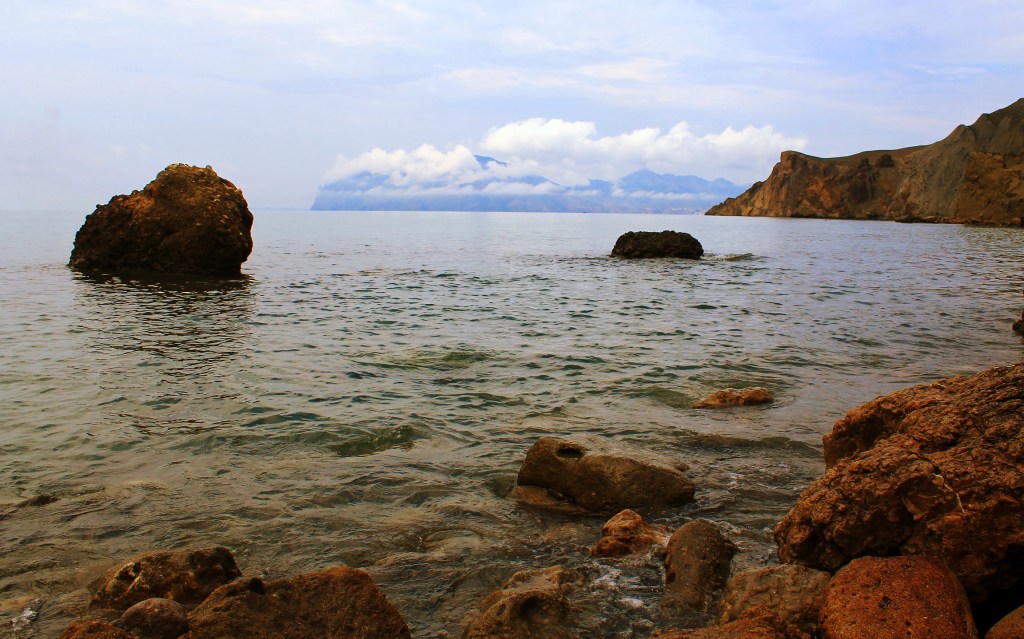
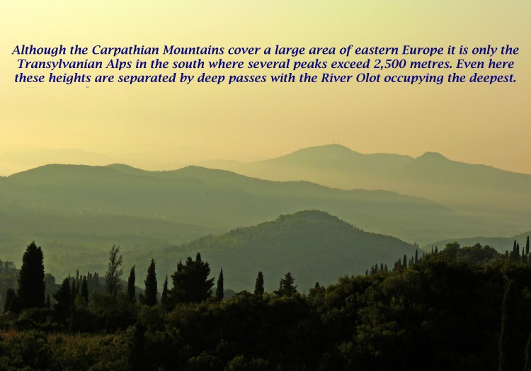
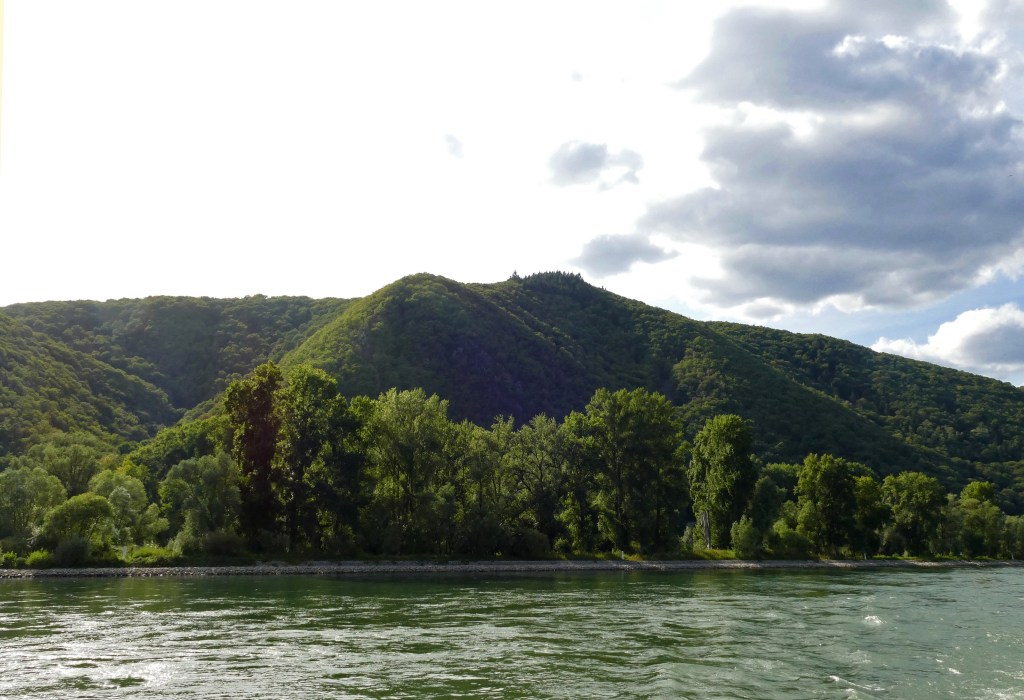
The Carpathian Mountains cover a large area of eastern Europe but it is only the Transylvanian Alps in the south where several peaks exceed 2,500 metres. Even here these heights are separated by deep passes with the River Olot occupying the deepest. However the mountains that curve away northwest, although less imposing, are the source of several long rivers flowing south into the Black Sea. The Dniester is the longest and marks the western limit of the Pontic Steppes.
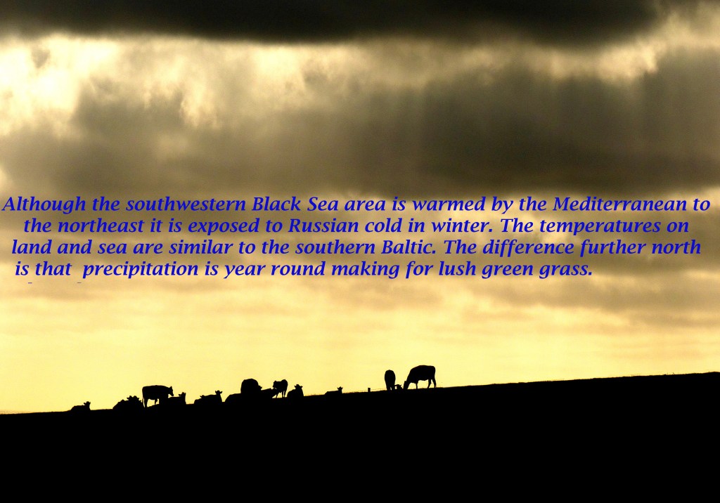
On the northern fringes of the Black Sea temperatures on land and sea in winter are similar to the southern Baltic. The main difference between these two areas is that precipitation is greater around the Baltic making it greener. This would have been attractive to Bronze Age dairy farmers living by the Black Sea where there were only pockets of lush pastures around its shores suitable for dairy farming. Around the southern Baltic however there was a vast area to expand into.
The spread of Indo-Europeans and the spread of cattle farming, especially dairy, are closely associated. It is therefore no surprise to find at the very beginning of the Norse creation myth Audhumla, a hornless cow with four udders, milk nourished Ymir the first being and later by licking the ice she helped to free Buri who was also nourished on her rich milk and begat a son called Burr.
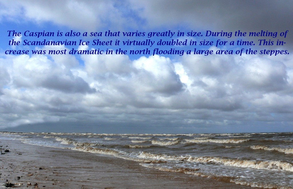
The Caspian Sea is in the middle of a continent and stretches ten degrees in longitude north to south, which is the equivalent from the Alps to Tunisia but it has varied greatly in size over time. At its northern end it is surrounded by windswept steppes open to Siberian blasts. It is also shallow here and liable to freeze.
This is in contrast to its southern end, which is surrounded by high mountains that catch the rain and remain green most of the year. Yet only a short distance up the coast on its eastern side the land quickly becomes arid and inland is the Kara Kum Desert – searingly hot in summer and numbingly cold in winter.
During the melting of the Scandinavian Ice Sheet the Caspian Sea virtually doubled in size for a time. This increase was most dramatic in the north flooding a large area of the steppes. Now it is slowly shrinking as it is reliant on just a few major rivers, mainly the Volga, to sustain it but these waters are also being abstracted for irrigation, industry and domestic use. It is likely that during the early Bronze Age the Caspian was bigger than it is now.