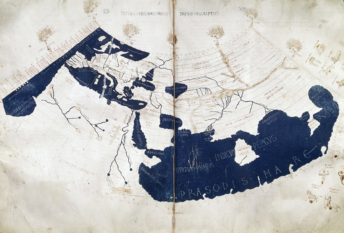
By the old world I am referring to the famous Ptolemy map which depicts the world stretching from the British Isles across to Sri Lanka. This was the world of the Iron Age and by the height of the Roman Empire was an integrated economic entity. During the Bronze Age though it was the area that Indo-Europeans spread across starting from their heartland on the Pontic Steppes, which was close to the middle of the known world until the Medieval period.
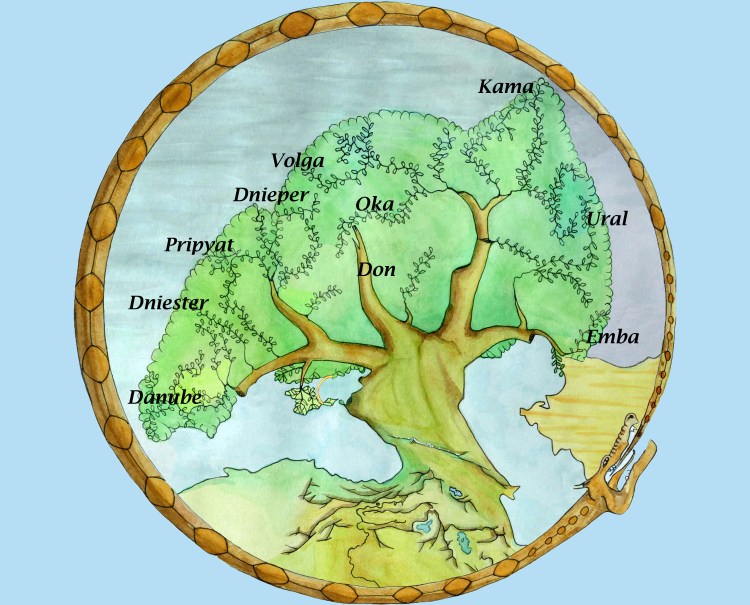
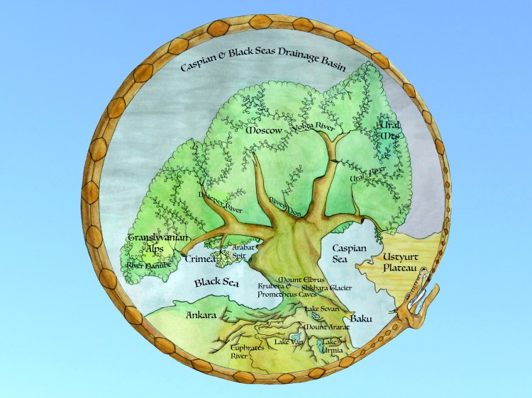
The depiction of my World Tree corresponds with the extent of the Black-Caspian Seas drainage basin. The branches with leaves mark the courses of major rivers. The black and brown markings at the base of the tree show the trend of the main mountain ranges from the Caucasus south into Anatolia giving the appearance of a tangle of roots. The coastlines of the Sea of Azov and the Caspian Sea are depicted as they might have been in the early Bronze Age 5,000 years ago. With the exception of the Caspian Sea it is fairly accurately depicted on the Ptolemy map including the major rivers including the Volga suggesting it was well integrated into the economy of the old world and close to its centre.